Reduce risk and deploy the right CAPEX
The large upfront capital allocated for the exploration stage made for leases, data acquisition/processing, and interpretation, always pressures the decision-making process to find completely new, previously unknown low-risk prospects.
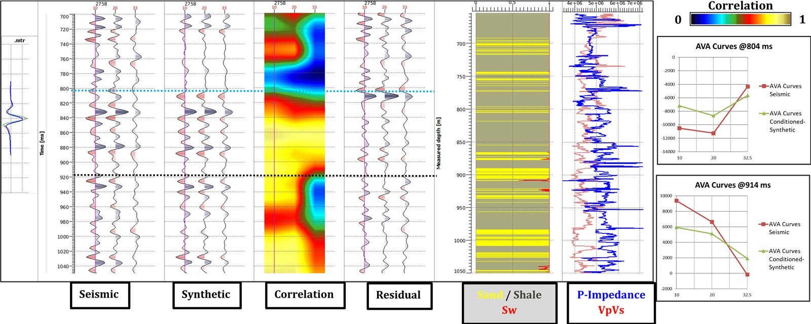
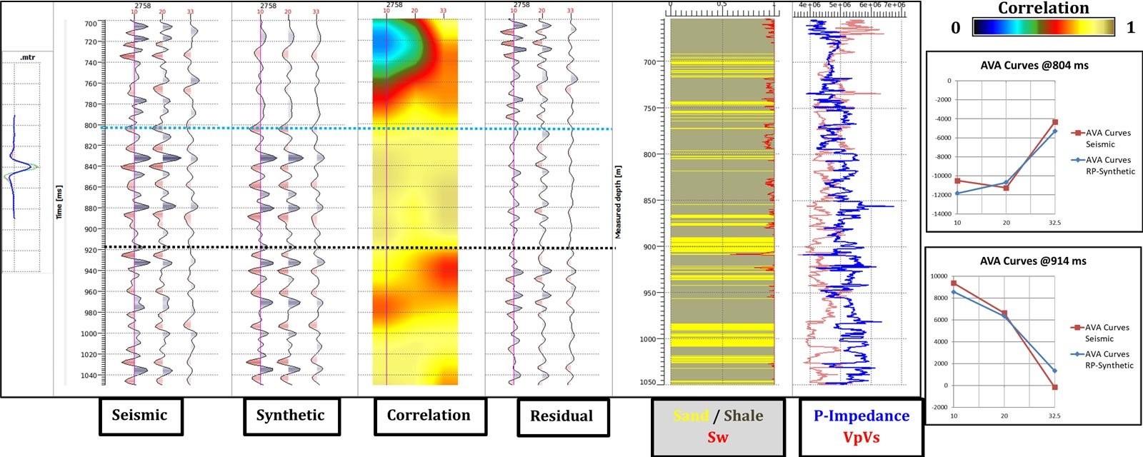
The few subsurface measurements available at the beginning of the exploration phase which may include stratigraphic maps, 2D/3D seismic data, topographic maps, and potential well analogy is by far a challenging task. Seismic data plays a major role in deriving the relative rock properties allowing geoscientists to define the reservoir limits and compartments. Well information if available; although, it may be located far from the area of interest could provide well control improving the decision-making process and improving the finding rate and success rate. This goal requires the art of integration of all available geophysical and geological data to differentiate high-risk from low-risk prospects and increase confidence on the overall investment decision.
Empowering prediction for strategic, repeatable play-based exploration success
Increasing the probability of success with the first wells drilled, both exploration and appraisal is highly valuable at this stage. GeoSoftware Services help companies get the answers they need for quick asset evaluation and improve their finding rates and drilling success rates by identifying low-risk drilling locations.
- Seismic interpretation alone provides a relative view of the subsurface, which can be correlated to general geologic knowledge to estimate facies and fluids.
- Well log and core plus seismic enables sharper detail, absolute rock properties and lower risk.
- Reconnaissance AVO analysis and AVO modeling to illuminate new prospects/leads, and refine risk assessments and attribute interpretation.
- EEI seismic inversion for rock and fluid interpretation.
- Rock physics-based machine learning for quantitative interpretation and feasibility studies in limited well control area.