Optimize well placement to enhance recovery
Efficiency, profitability, and sustainability of resource extraction projects can be impacted by key challenges in the development and production stages. Complex geological structures, reservoir heterogeneity, and subsurface uncertainty along with environmental concerns pose challenges in accurately characterizing subsurface conditions. Understanding and modeling this complexity is crucial for developing effective strategies to optimize resource recovery, maximizing profitability while improving fiscal uncertainty and lowering environmental impact. GeoSoftware advancement in technology and expertise in building detailed subsurface models enables operators to achieve development and production success with accurate drilling plans that interconnect all available geoscience data.
Maximize production and ensure long-term sustainability
For the field development stage, the GeoSoftware team will accurately characterize lithology, fluid properties, and continuity as well as estimate volumetrics and map fractures. In this way, we understand subtle reservoir variations and reduce the overall cost of wells by predicting drilling hazards such as faults and overpressure zones as well as dry holes.
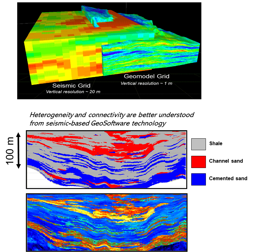
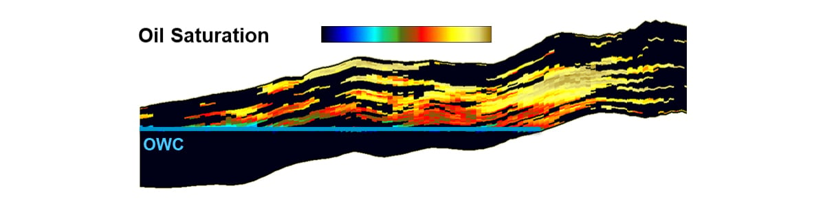
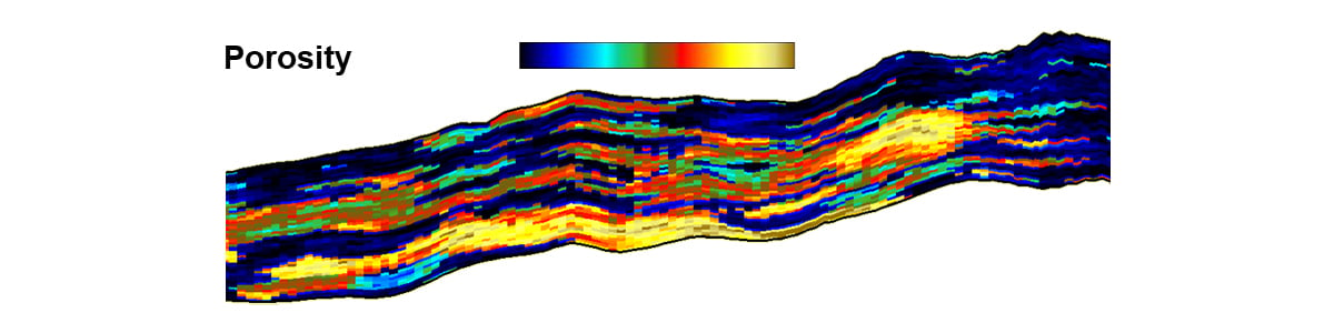
Since the field is in the production stage, product geophysics is applied to understand the field as it evolves. The team will use geostatistical seismic inversion to map permeability barriers, estimate reservoir connectivity, and determine sweep. This work shows the drivers behind areas of low performance (if any), improves overall understanding of the field, updates the recovery scheme and well spacing, and optimizes total field production. Time lapse studies can calibrate and identify updates to the production plan based on changes over time. 4D studies can be conducted to determine the changes in the field over time that may indicate bypassed areas for further infill drilling. Here are details on how GeoSoftware's work enables development and production plans:
- Identify and characterize distinct rock formations based on their lithology to reconstruct the subsurface and identify the potential for hydrocarbon reservoirs.
- Optimize drilling targets by evaluating producers and injector wells based on maximum porosity, permeability, reservoir connectivity, and drainage area.
- Maximize well trajectories by ensuring maximum reservoir contacts with hydrocarbon pay zones for unconventional wells and improve well life expectancy by avoiding hazard zones.
- Maximizing the understanding of faults/fracture distribution and reservoir heterogeneity to optimize EOR strategy and reservoir management for carbonate reservoirs.
Deliver fine-scale models at the resolution necessary for static and dynamic models